PAGASA Releases Latest Weather Update for Saturday (February 7, 2026)
PAGASA LATEST UPDATE – The state weather bureau reported that Tropical Depression Basyang has weakened into a low-pressure area.
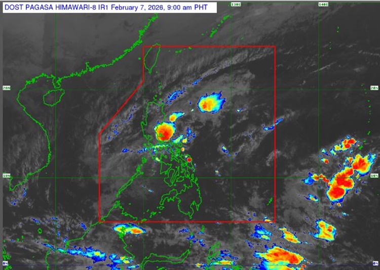
On Saturday (February 7, 2026), the Philippine Atmospheric, Geophysical, and Astronomical Services Administration released the latest weather update in the country. The low-pressure area will continue to affect the country’s weather conditions.
Basyang was last spotted 105 km southeast of Cuyo, Palawan. It has a low chance of developing into a tropical depression within the next 24 hours.
” PAGASA said.
The shear line will continue to bring heavy rainfall over Quezon and Camarines Norte. It will bring cloudy skies with scattered rains and isolated thunderstorms over Metro Manila, Calabarzon, the Bicol Region, Aurora, Northern Samar, and Eastern Samar.
The northeast monsoon will bring similar weather conditions over Metro Manila, Calabarzon, the Bicol Region, Aurora, Northern Samar, and Eastern Samar.
Most of Luzon, Western Visayas, most of the Negros Island Region (NIR), and Zamboanga del Norte will experience strong to gale force winds.
The weather agency also advised fisherfolks to take precautionary measures when venturing into the sea due to rough coastal water conditions.
The remaining seaboards of the Ilocos Region, the northern seaboards of Camarines Norte and Camarines Sur, the northern and eastern seaboards of Catanduanes and Northern Samar, and the eastern seaboards of Albay, Sorsogon, Eastern Samar, Dinagat Islands, Siargao-Bucas Grande Islands, Surigao del Sur, and Davao Oriental will have moderate surrounding sea conditions.
PAGASA
advised the public to take precautionary measures for possible flash floods or landslides due to moderate to at times heavy rains.
READ ALSO:
PAGASA: Signal No. 2 Up in 15 Areas Due to Tropical Storm Basyang