LPA enters PAR and turns into Tropical Depression Basyang.
The low pressure area (LPA) being monitored outside the Philippine Area of Responsibility (PAR) is now Tropical Depression Basyang.
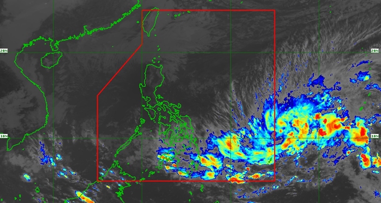
The Philippine Atmospheric, Geophysical, and Astronomical Services Administration (PAGASA) has issued an update at 5 PM about the low pressure area (LPA) being monitored outside the Philippine Area of Responsibility (PAR).
Based on the update, the tropical depression is expected to enter PAR on Tuesday evening or early Wednesday morning, February 4.
In the recent weather bulletin, the LPA has entered PAR and is named Tropical Depression Basyang. At 5:30 PM today, the LPA entered PAR and was called Basyang.
According to the update, the center of the tropical depression was estimated based on all available data at 1,075 km East of Northeastern Mindanao, which was still outside PAR at this time. It has maximum sustained winds of 55 km/h near the center, gustiness of up to 70 km/h, and a central pressure of 1002 hPa.
Basyang moves Northwestward slowly.
Based on the forecast, Basyang will turn westward while over the Philippine Sea, and may make landfall in Caraga by Thursday afternoon or evening, February 5. It will be crossing the Visayas and Palawan from Friday to Sunday.
Basyang will continue to intensify and may reach the tropical storm category tomorrow evening or Thursday early morning. Further intensification is expected before the landfall. The highest wind signal that will be hoisted is Wind Signal No. 2.
As stated: