PAGASA released the latest update about Wilma PH and the areas that are under Signal No. 1.
WILMA PH UPDATE – PAGASA has released the latest information about the tropical depression and the areas that are in Signal No. 1.
The Philippine Atmospheric, Geophysical, and Astronomical Services Administration (PAGASA) released the latest update about
Tropical Depression
Wilma. On December 5, the weather agency released the latest information about the tropical depression at 8 PM.
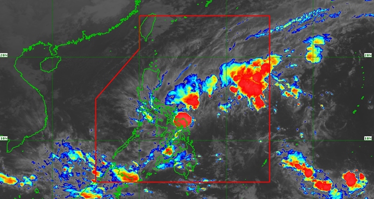
According to the update, Wilma is moving towards Eastern Visayas at a slow movement, going westward. At 7 PM, the location of its center was at 170 km East of Borongan City, Eastern Samar (11.7°N, 127.0°E). It has maximum sustained winds of 45 km/h near the center, gustiness of up to 55 km/h, and a central pressure of 1004 hPa.
TROPICAL CYCLONE WIND SIGNALS (TCWS) IN EFFECT
Signal No. 1
Luzon:
The southern portion of Sorsogon (Matnog, Bulan, Irosin, Santa Magdalena, Bulusan, Barcelona, Magallanes, Juban, Casiguran, Gubat), mainland Masbate including Ticao Island, and the eastern portion of Romblon (San Fernando, Cajidiocan, Magdiwang)
Visayas:
Northern Samar, Eastern Samar, Samar, Biliran, Leyte, Southern Leyte, Cebu including Bantayan and Camotes Islands, Bohol, the northern and central portions of Negros Occidental (Sagay City, City of Escalante, Toboso, Calatrava, Enrique B. Magalona, City of Victorias, Manapla, Cadiz City, Bacolod City, City of Talisay, Silay City, Salvador Benedicto, San Carlos City, Murcia, Bago City, La Carlota City, La Castellana, Moises Padilla, Valladolid, Pulupandan, San Enrique, Pontevedra, Hinigaran, Isabela, Binalbagan, City of Himamaylan, City of Kabankalan), Siquijor, the northern and central portions of Negros Oriental (City of Guihulngan, Canlaon City, Vallehermoso, La Libertad, Jimalalud, Tayasan, Ayungon, Bindoy, Manjuyod, Bais City, Pamplona, City of Tanjay, Amlan, San Jose, Dumaguete City, Valencia, Sibulan, Bacong, Mabinay), Guimaras, the northern and central portion Iloilo (San Dionisio, Estancia, Batad, Carles, Concepcion, Ajuy, Sara, Balasan, Lemery, Barotac Viejo, San Rafael, City of Passi, San Enrique, Anilao, Banate, Dingle, Barotac Nuevo, Mina, Pototan, New Lucena, Santa Barbara, Pavia, Iloilo City, Leganes, Zarraga, Dumangas, Dueñas, Bingawan, Lambunao, Calinog, Janiuay, Badiangan, Cabatuan, Maasin, Alimodian, San Miguel, Oton), Capiz, and the eastern portion of Aklan (Altavas, Batan, New Washington, Kalibo, Banga, Balete, Libacao, Madalag),
Mindanao:
Surigao del Norte including Siargao and Bucas Grande Islands, Dinagat Islands, the northern portion of Surigao del Sur (Carrascal, Cantilan, Madrid, Carmen, Lanuza), the northern portion of Agusan del Norte (Kitcharao, Jabonga, Santiago, Tubay, City of Cabadbaran, Remedios T. Romualdez, Magallanes), and Camiguin
Based on the forecast, the tropical depression is expected to move west-southwest until tomorrow, then head west. It may make landfall in Eastern Visayas tomorrow and cross the Visayas until Sunday. By Monday morning, it is forecast to enter the Sulu Sea and pass near northern Palawan.